With summer well and truly here and ongoing high temperatures on the French Riviera, I thought it’s timely for a reminder post about the Canadair scooping zones including maps.
The third most wooded department in the south – the Provence Alpes Côte d’Azur region, has more than 257,000 hectares of forest which represents 60% of the total area of the department.
Every year, pompiers, the pilots of the helicopters, Canadairs and Dash planes, and the Sécurité Civile are out there on the line to protect or preserve people, property, and wildlife.
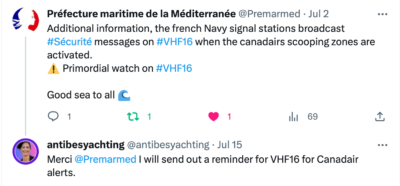
The Canadair planes are important to fight forest fires here in southern France and it’s a timely reminder for yachts to be vigilant and stay clear of the water-scooping zones. It seems logical to heed the information of the ports and Préfecture Maritime, however every year there are people who risk their safety and endanger others by getting in the way.
You might spot the planes in this region everywhere from Marseille to Villefranche-sur-Mer. The pilots fly overhead so people on the water can see them. In the event of scooping, the planes make one or more passes at very low altitudes above the presentation axis before touching the sea. They have a carrying capacity of 6000 litres, taking up to 12 seconds to fill the water tanks. They can make up to 48 airdrops in 3 hours. During the scooping phases, the Canadairs are effectively not very manoeuverable and they have priority over other aircraft that can use the water (civilian seaplanes, microlights).
“Protecting land and people is more than just a professional value,” a Canadair Commander said. “It’s what Canadair pilots do. It’s in our DNA.”
You may have seen some prior videos online that the Sécurité Civile posted showing boats a few metres from the Canadairs who came to collect water in the bay of Saint-Tropez to extinguish a fire that destroyed nearly 5,000 hectares in the Var in the past. Take a look at this video by Le Parisien on YouTube: https://youtu.be/n05ZwvIXg9M
The Gendarmerie Maritime and Civil Security asks boaters, jet skiers etc not to get in the way of the Canadair scooping areas. In practice, from the overflight, any person or watercraft (swimmer, diver, yacht, etc.) must move away as quickly as possible more than 500 metres from the presentation axis. Furthermore, you must stay out of the scooping zone throughout the duration of the operations and until one hour after the passage of the last plane, otherwise, you will be fined. Any offender will have to pay a fine of 135 euros.
Canadair approaches ARE NOT the time or place to get selfies! This is an attitude that endangers the occupants of watercraft, as well as the Canadair pilots who must already perform a difficult operation to bail out.
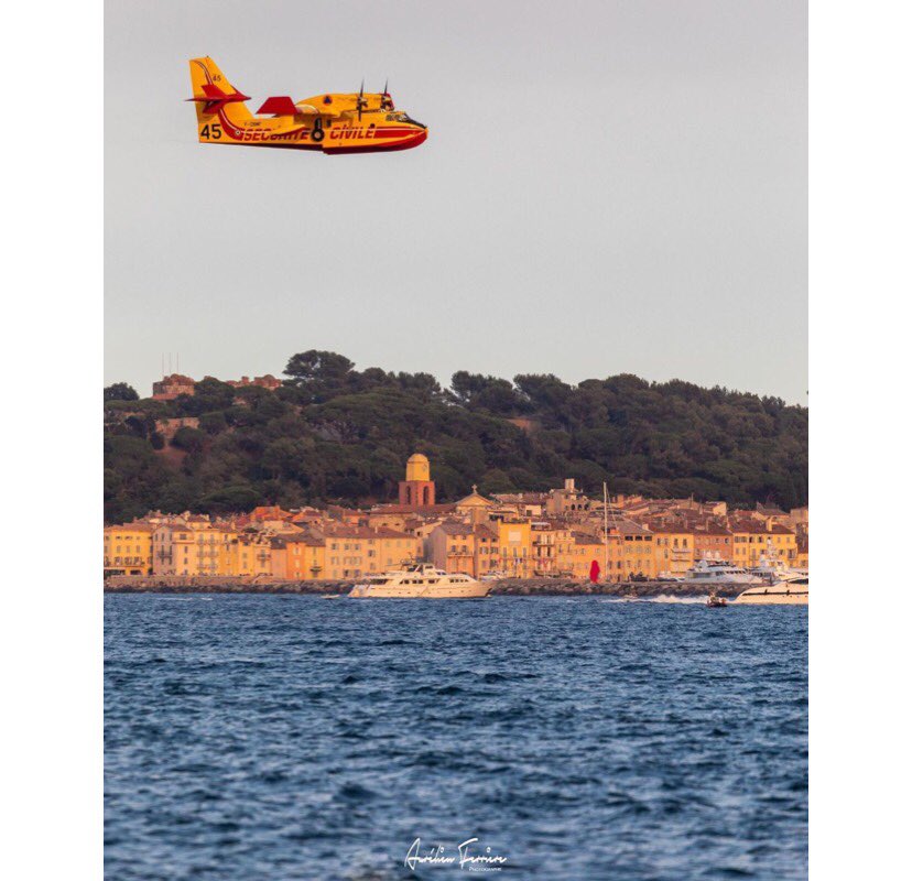
Canadair near St-Tropez (photo: Aurelien Ferriere; https://www.instagram.com/aurelienferriere)
IMPORTANT LINKS:
- Thanks to the Préfecture Maritime for providing me the link to the current info with the maps for Canadair scooping zones. You can find that here (in French language): https://www.premar-mediterranee.gouv.fr/uploads/mediterranee/arretes/4e33402666a06f854853da46481bbe5e.pdf
3. Find the daily Fire Risk Alert map for the Var here. It’s published daily at 19h for the next day: https://www.risque-prevention-incendie.fr/var/
You can also find the daily fire risk updates for the Var on Twitter: www.twitter.com/Prefet83 and Facebook: www.facebook.com/Prefet83
Météo-France and the National Forestry Office (ONF) will provide more precise forecasts: “We will have a twice-daily strategic analysis of all the departments of the southern zone and the south-western zone, so we will be able to make a comparison of the dangers and the risks. As soon as a risk is determined, 2 Canadairs will be positioned immediately.”
4. Forest fire risk updates are posted daily by Sécurité Civile on their Twitter account: www.twitter.com/SecCivileFrance
5. The National Park of Port Cros (Porquerolles) has its own alerts which you can see here: https://www.portcros-parcnational.fr/fr/le-parc-national-de-port-cros/la-reglementation/reglementation-terre/fermeture-des-massifs and also updates on Twitter: https://twitter.com/PNPC83
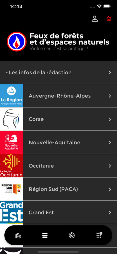
6. You can download the “Feux de Forêt” app (French language) on the App Store or Google Play.
What to do if you see a forest fire
If you witness a forest fire in the region, you can call 18 or 112. Or if you have the Feux de Forêt app you can signal a forest fire with GPS coordinates inside the app or there are DFCI grids that are used by civil security.
Please share this post to your networks, especially yachties in southern France.
Main image credit: AFP
#SecuriteCivile #Canadair #Yachting